Map Support
The Tool enables the geographical diagrams and geo neighborhood diagrams to be displayed on top of selected Maps.
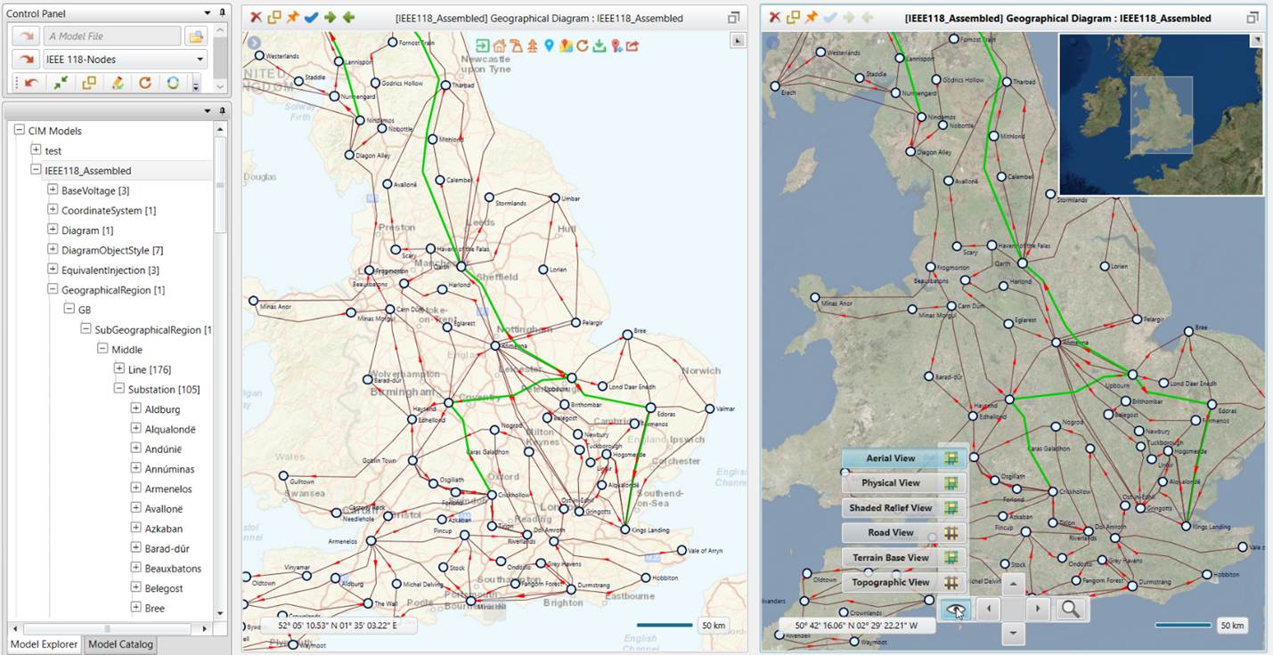
The Tool provides many options and nice features, such as a mini map, navigation control panel, switching map at run time, etc.
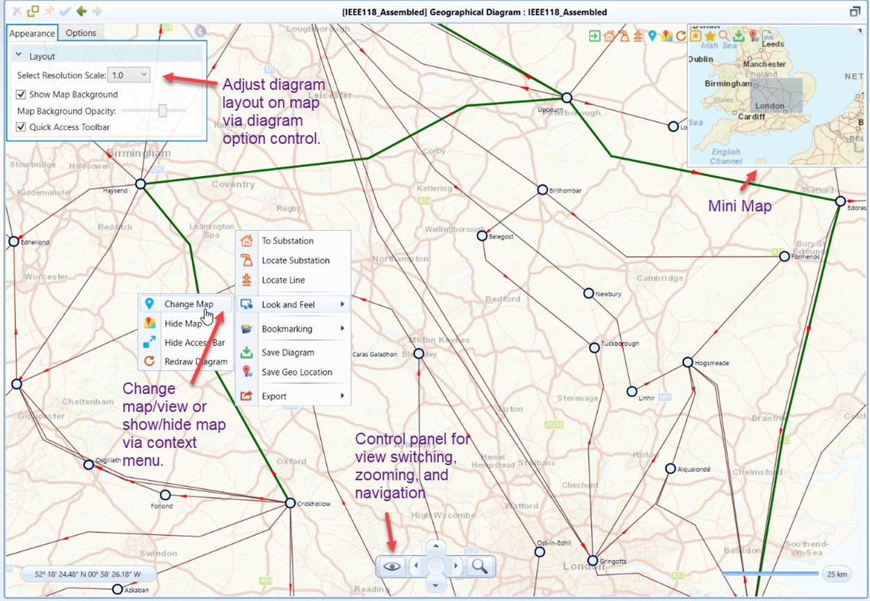
More specifically, the Tool supports:
- ArcGIS
- Street (default)
- Aerial
- Physical
- Shaded Relief
- Terrain
To make the permanent change for map/view, users can change the custom configuration file. The map support can be configured in AddonConfig.xml under folder \CIMSpy\config\ui, as illustrated below:
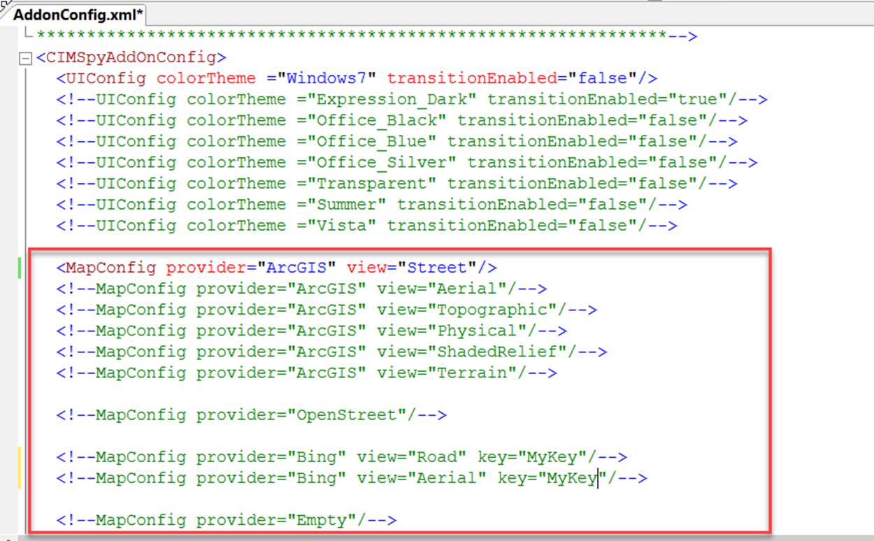
To enable the selected map/view, you must comment the rest of the map/view using “<!—“ and “-->”., and then restart the application or dynamically update the config at run time.
Users can also change the map/view at run time, as illustrate below..
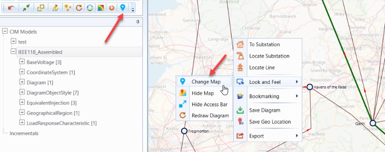
If users select to save the selected map/view, the new map/view will be applied everytime when the Tool is started.
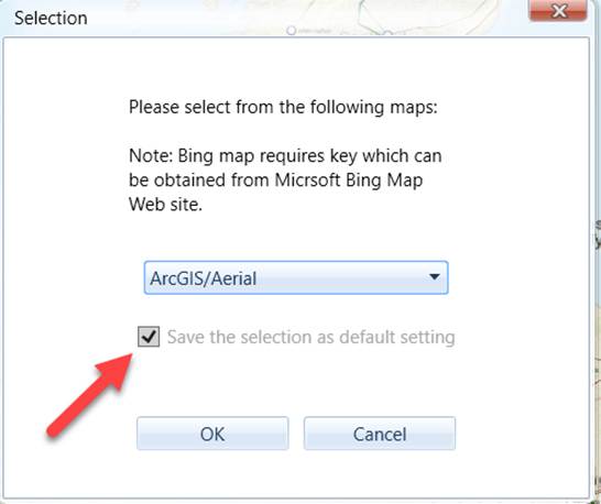
Once users choose to “Save the selection as default setting”, the new map/view will become persistent setting and is automatically applied when the application is started next time. In other words, the selected map/view will overwrite the map/view in the configuration file. To restore the map/view in the configuration file, simply reset UI settings.