Saving a Geographical Diagram
The Tool enables users to adjust a geographical diagram and save the adjusted geographical diagram either as a geographical diagram conforming to ENTSO-E Geographical Profile, which is derived from IEC 61968-Part 13, or as a geo-schematic diagram, conforming to IEC 61970-453.
Updating a Geographical Diagram
The geographical diagram is aid out based on the geographical locations of the substations and lines. The Tool enables users to adjust the rendered geographical diagrams for any reasons. The adjusted geographical diagram can be saved to replace the original geographical locations. The updated geographical locations can be furher exported as a CIM/XML file seperately or along with the model.
To update gepgraohical locations of an adjusted geographical diagram
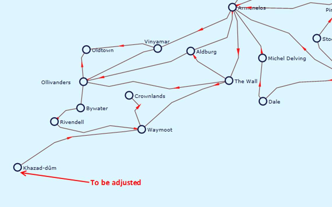
- Start with a geographical diagram and adjust the geographical diagram by dragging and dropping the graphical sumbols that represent substations and lines in the geographical diagram.
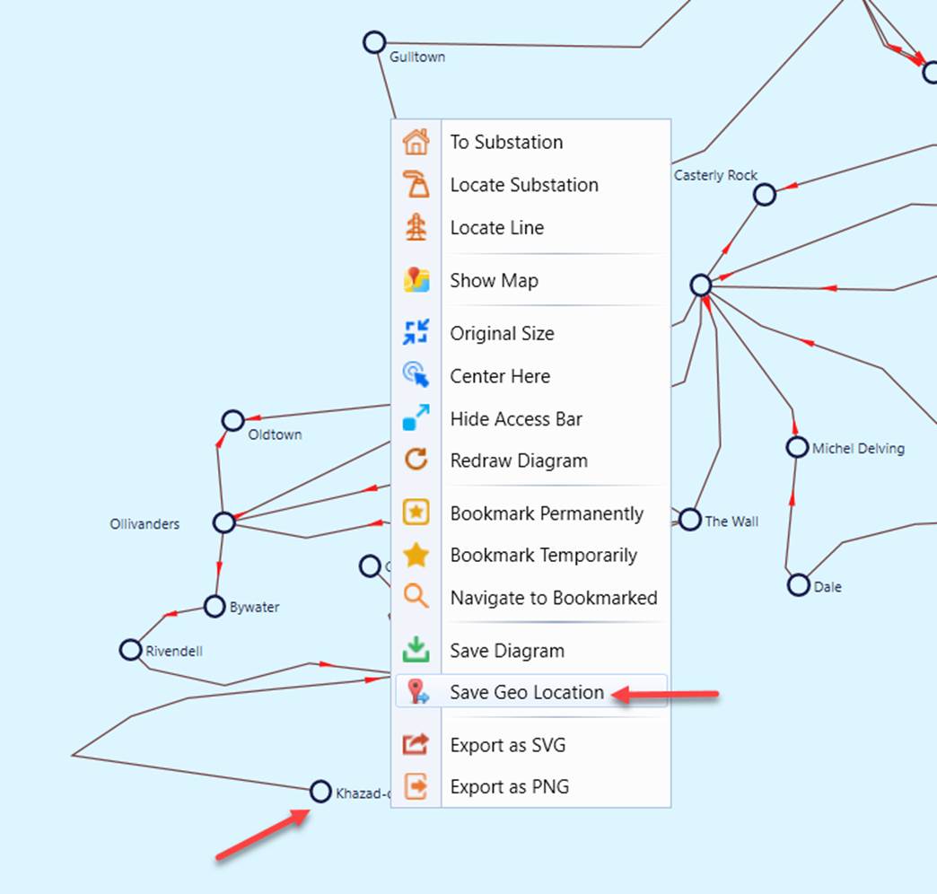
- Right-mouse-click any blank spot in a geographical diagram and select “Update Geo Location” in the context menu as illustrated below. Note this menu item only appears in the geographical diagram. It doesn’t appear in the geo-schematic diagram, which is a snapshot of the geographical diagram
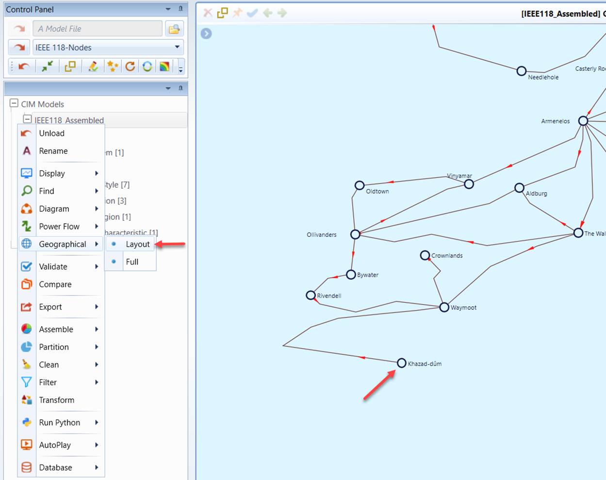
- Call the geographical diagram again to confirm that the adjusted geographical locations are saved and the adjusted geographical diagram shall be fully restored.
- Export the saved geo locations as a CIM/XML file seperately or along with the model.
Saving a Geographical Diagram as a Geo-Schematic Diagram
A geo-schematic diagram is stored as a schematic diagram, but contains the geographical information. It is rendered as a geographical diagram in the Tool. It is important to keep in mind that a geo-schematic diagram is a snapshot of the geographical diagram when the geo-schematic diagram is created. If the geographical diagram is later updated as described above, any of the geo-schematic diagrams derived from the previous geographical diagrams will not be updated. Fundamentally, there is only one geographical diagram system wide, but users can create unlimited number of geo-schematic diagrams. Again, geo-schematic diagrams are the snapshots of the reality-based geographical diagram. They are used as starting point for creating geographic-based schematic diagrams.
To save a geographical diagram as a geo-schematic diagram:
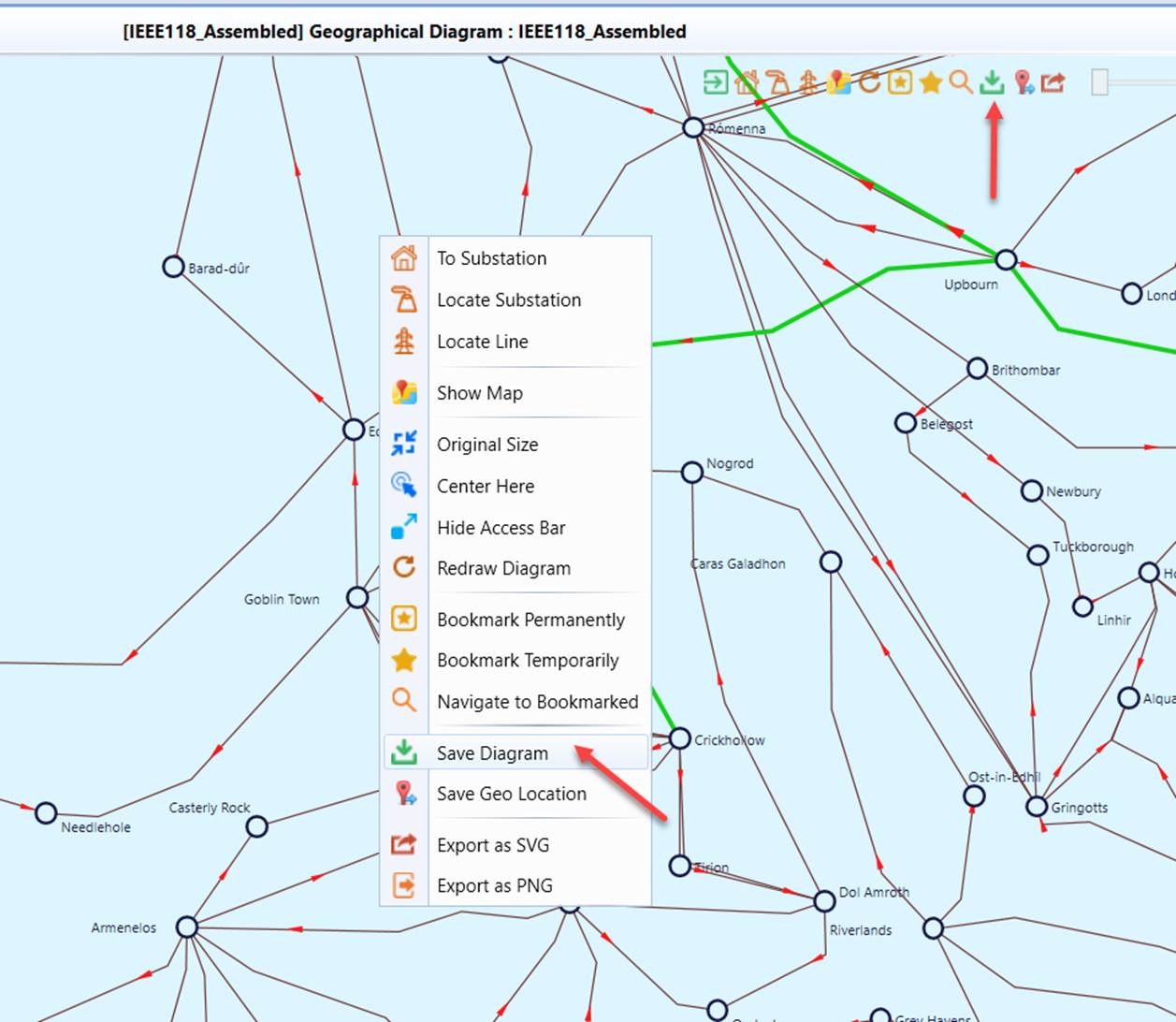
- Right-mouse-click any blank spot in a geographical or geo-schematic diagram and select “Save Diagram” in the context menu as illustrated below.
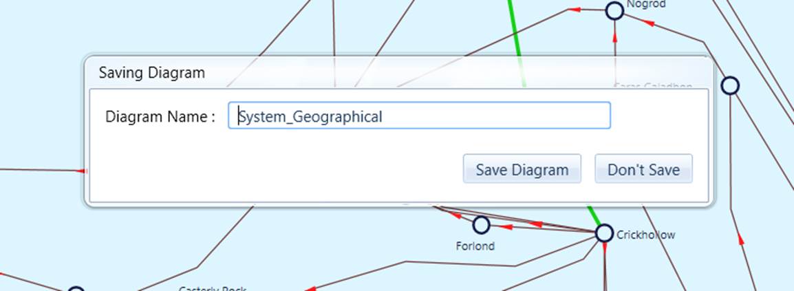
- An edit box, filled with a default name, will appear, prompting users to enter a name for the saved diagram. Click the “Save Diagram” button.
- Once the diagram is saved to the in-memory model, you will see a CIM Diagram object added at the bottom of the navigation tree. The saved diagram will be automatically displayed on the current model view. The saved Diagram is based on CIM Diagram Profile (CIM 16), but contains some extensions to retain the geographical locations. The saved geo-diagram is CIM16 – compliant, I.e. conforming to IEC 61970-453, meaning consumable by foreign applications. Even your model version is below CIM 16, the diagram saving feature is still fully functional.
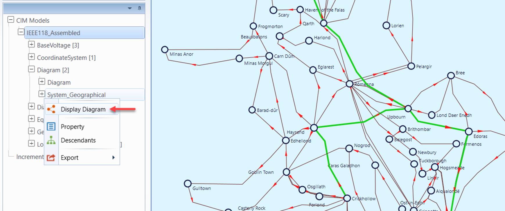
- Users can restore the saved diagram via context menu (i.e. by clicking the Layout menu item) associated with the saved Diagram object as illustrated below.
- Export the saved geo-schematic diagrams as a CIM/XML file seperately or along with the model.
Adapting to Model Changes
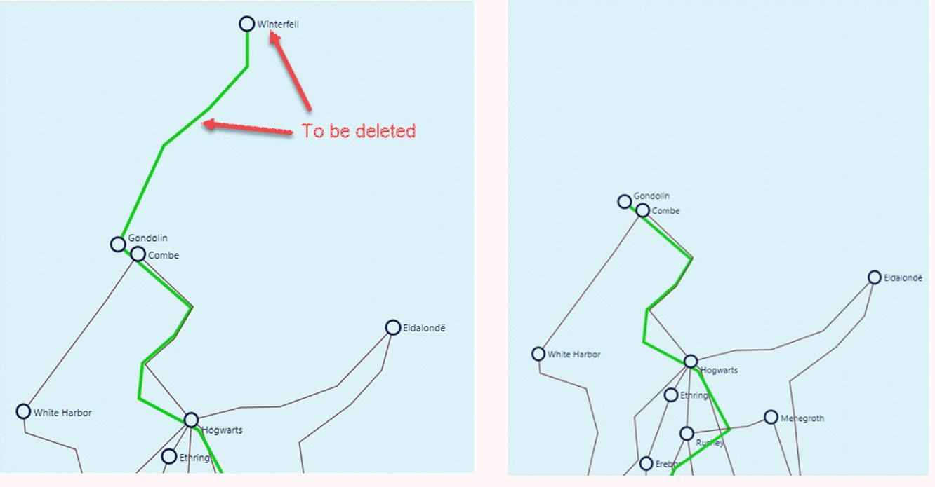
The saved geo schematic diagram is a snapshot of the model presentation. However, the underlying model could be changed, for example, using the model editing function of the Tool. The underlying model could also be maintained in other modeling environments. When rendering any saved geo-schematic diagrams, the diagram rendering algorithm of the Tool checks the consistency between the saved diagram objects with the underlying model. If inconsistencies are detected, the diagram rendering algorithm will rectify the original saved diagram to adapt to the model change. Assuming we delete Substation Winterfell and the connected Line/ACLineSegmen, as illustrated below. When restoring the previously saved geo-schematic diagram, the diagram rendering engine detects this model change and makes the corresponding changes in the rendered diagram, as illustrated below. Users will be informed of these changes.
It is important to note that rectification of the saved diagrams to adapt the model changes may not result in the perfect layout of the new diagram. It is based on the optimal graph layout algorithm. It is expected that that users would adjust the rectified diagrams and save the adjusted diagram.